|
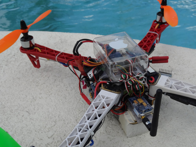
First you need the basic 3 sensors to
provide Inertial Measurement Unit (IMU).
The sensors will consist of the
accelerometer, gyroscope and magnetometer.
We then add the CPU, a Global Positioning System (GPS)
receiver and a Barometric Pressure Sensor. An
accelerometer is an instrument that measures proper acceleration. The proper acceleration measured by an accelerometer is not necessarily the rate of change of velocity. For example, an accelerometer at rest on the surface of the earth will measure an acceleration g= 9.81 m/s2 straight upwards, due to its weight. By contrast, accelerometers in free fall or at rest in outer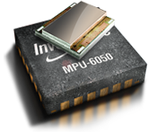 space will measure zero. You may have heard
of the term g-force, it is another word for
the type of acceleration that accelerometers
can measure. By measuring the amount of
static acceleration due to gravity, you can
find out the angle the device is tilted at
with respect to the earth. By sensing the
amount of dynamic acceleration, you can
analyze the way the device is moving.
Measuring tilt and acceleration doesn't seem
all that exciting, however engineers have
come up with many ways to make really useful
products with them, things you may have been
using for years, such as your car airbags.
On a drone, what we want to achieve is an accelerometer
that can help us understand its surroundings better. Is it
diving or flying horizontally? A programmer can write code to
translate and make decisions using the data provided
by an accelerometer. There are many
different ways to make an accelerometer!
Some accelerometers use the piezoelectric
effect - they contain microscopic crystal
structures that get stressed by accelerative
forces, which causes a voltage to be
generated. Another way to do it is by
sensing changes in capacitance. If you have
two microstructures next to each other, they
have a certain capacitance between them. If
an accelerative force moves one of the
structures, then the capacitance will
change. Add some circuitry to convert from
capacitance to voltage, and you will get an
accelerometer.
space will measure zero. You may have heard
of the term g-force, it is another word for
the type of acceleration that accelerometers
can measure. By measuring the amount of
static acceleration due to gravity, you can
find out the angle the device is tilted at
with respect to the earth. By sensing the
amount of dynamic acceleration, you can
analyze the way the device is moving.
Measuring tilt and acceleration doesn't seem
all that exciting, however engineers have
come up with many ways to make really useful
products with them, things you may have been
using for years, such as your car airbags.
On a drone, what we want to achieve is an accelerometer
that can help us understand its surroundings better. Is it
diving or flying horizontally? A programmer can write code to
translate and make decisions using the data provided
by an accelerometer. There are many
different ways to make an accelerometer!
Some accelerometers use the piezoelectric
effect - they contain microscopic crystal
structures that get stressed by accelerative
forces, which causes a voltage to be
generated. Another way to do it is by
sensing changes in capacitance. If you have
two microstructures next to each other, they
have a certain capacitance between them. If
an accelerative force moves one of the
structures, then the capacitance will
change. Add some circuitry to convert from
capacitance to voltage, and you will get an
accelerometer.
 A Gyroscope measures either changes in orientation or or changes in rotational
velocity. Mechanically, a gyroscope is a top, a self-balancing spinning toy, put
to instrumental use. A vibrating structure gyroscope is a type of gyroscope that functions much like the halteres of an insect. Halteres
flap up and down as the wings do and if the body of the insect changes direction in flight or rotates about its axis, the vibrating halteres thus exert a force on the body. The insect detects this force with sensory organs known as campaniform sensilla located at the base of the halteres. The planes of vibration of the two halteres are orthogonal to each other, each forming an angle of about 45 degrees with the axis of the insect; this increases the amount of information gained from the halteres.
Halteres thus act as a balancing and guidance system, helping these insects to
perform their fast aerobatics. In addition to providing rapid feedback to the
muscles steering the wings, they also play an important role in stabilizing the
head during flight. Gyroscopes in consumer electronics are frequently
combined with accelerometers (acceleration sensors) for more robust direction-
and motion-sensing. What we try to achieve on a Drone
is to keep the aircraft stabilized, self-balancing all the time using a vibrating structure gyroscope.
You may have tried a Nintendo Wii or tilting your smart phone,
camera or ipad that rotates your screen; all these electronics uses gyroscope. A Gyroscope measures either changes in orientation or or changes in rotational
velocity. Mechanically, a gyroscope is a top, a self-balancing spinning toy, put
to instrumental use. A vibrating structure gyroscope is a type of gyroscope that functions much like the halteres of an insect. Halteres
flap up and down as the wings do and if the body of the insect changes direction in flight or rotates about its axis, the vibrating halteres thus exert a force on the body. The insect detects this force with sensory organs known as campaniform sensilla located at the base of the halteres. The planes of vibration of the two halteres are orthogonal to each other, each forming an angle of about 45 degrees with the axis of the insect; this increases the amount of information gained from the halteres.
Halteres thus act as a balancing and guidance system, helping these insects to
perform their fast aerobatics. In addition to providing rapid feedback to the
muscles steering the wings, they also play an important role in stabilizing the
head during flight. Gyroscopes in consumer electronics are frequently
combined with accelerometers (acceleration sensors) for more robust direction-
and motion-sensing. What we try to achieve on a Drone
is to keep the aircraft stabilized, self-balancing all the time using a vibrating structure gyroscope.
You may have tried a Nintendo Wii or tilting your smart phone,
camera or ipad that rotates your screen; all these electronics uses gyroscope.
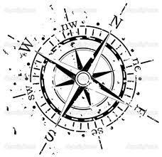 A magnetometer is a measuring instrument used to measure the strength and the direction of magnetic fields. Magnetometers can be divided into scalar devices which only measure the intensity of the field and vector devices which also measure the direction of the field.
Magnetometers point to the magnetic north. We use the magnetometer as a digital compass,
determine headings to assist with waypoints or
autopilot during a mission. The magnetic north is constantly changing in location and strength,
therefore we need the GPS to assist with identifying the location. A magnetometer is a measuring instrument used to measure the strength and the direction of magnetic fields. Magnetometers can be divided into scalar devices which only measure the intensity of the field and vector devices which also measure the direction of the field.
Magnetometers point to the magnetic north. We use the magnetometer as a digital compass,
determine headings to assist with waypoints or
autopilot during a mission. The magnetic north is constantly changing in location and strength,
therefore we need the GPS to assist with identifying the location.
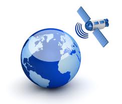 A GPS
receiver calculates its position by precisely timing the signals sent by GPS
satellites high above the Earth. Each satellite continually transmits messages
that include the time the message was transmitted satellite position at time of
message transmission. The receiver uses the messages it receives to determine
the transit time of each message and computes the distance to each satellite
using the speed of light. Each of these distances and satellites' locations
define a sphere. The receiver is on the surface of each of these spheres when
the distances and the satellites' locations are correct. These distances and
satellites' locations are used to compute the location of the receiver using the
navigation equations. This location is then displayed, with a moving map display
or latitude and longitude; elevation information included and derived
information such as direction and speed, calculated from position changes.
On a Drone, the system is constantly aware of it's current location and stores
the GPS coordinates to fly to, hold or return back. In a typical GPS
operation, three or more satellites must be visible to obtain an accurate result
and to triangulate a position;
on the average we use about eight or more satellites. A GPS
receiver calculates its position by precisely timing the signals sent by GPS
satellites high above the Earth. Each satellite continually transmits messages
that include the time the message was transmitted satellite position at time of
message transmission. The receiver uses the messages it receives to determine
the transit time of each message and computes the distance to each satellite
using the speed of light. Each of these distances and satellites' locations
define a sphere. The receiver is on the surface of each of these spheres when
the distances and the satellites' locations are correct. These distances and
satellites' locations are used to compute the location of the receiver using the
navigation equations. This location is then displayed, with a moving map display
or latitude and longitude; elevation information included and derived
information such as direction and speed, calculated from position changes.
On a Drone, the system is constantly aware of it's current location and stores
the GPS coordinates to fly to, hold or return back. In a typical GPS
operation, three or more satellites must be visible to obtain an accurate result
and to triangulate a position;
on the average we use about eight or more satellites.
Barometric Pressure Sensor measures pressure by using the piezoresistive effect, bonded or formed strain gauges to detect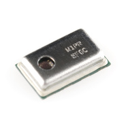 strain due to applied pressure. This technology is commonly employed for the measurement of highly dynamic pressures.
There is linear relationship between pressure and altitude, as such a pressure
sensor can help derived altitude and assist in various functions from landing to altitude hold
of an aircraft. All these applications make use of the relationship between
changes in pressure relative to the altitude. This relationship is governed by
this equation: strain due to applied pressure. This technology is commonly employed for the measurement of highly dynamic pressures.
There is linear relationship between pressure and altitude, as such a pressure
sensor can help derived altitude and assist in various functions from landing to altitude hold
of an aircraft. All these applications make use of the relationship between
changes in pressure relative to the altitude. This relationship is governed by
this equation:
 This
equation is calibrated for an altimeter,
up to 36,090 feet (11,000 m). Outside
that range, an error will be introduced
which can be calculated differently for
each different pressure sensor. These
error calculations will factor in the
error introduced by the change in
temperature as we go up.
Barometric pressure sensors can have an
altitude resolution of less than 1
meter, which is significantly better
than GPS systems that has about a 20
meters altitude resolution.
Trainee's
video tutorial links
Reading
You can also read
more about UAVs at:
- multiwii.com
- openpilot.org/videos/
- diydrones.com
- flyingeinstein.com
OSD Virtual Cockpit
|
DIY & GETTING STARTED|
SHOP
|